
 |
2nd Light Forums |
 |
 |  |


|
Topic Title: Tropical Storm Earl Topic Summary: Created On: 09/03/2022 07:09 AM |
Linear : Threading : Single : Branch |
|
 Topic Tools Topic Tools
|

 09/03/2022 07:09 AM 09/03/2022 07:09 AM


|
|
|
Tropical Storm Earl Discussion Number 2
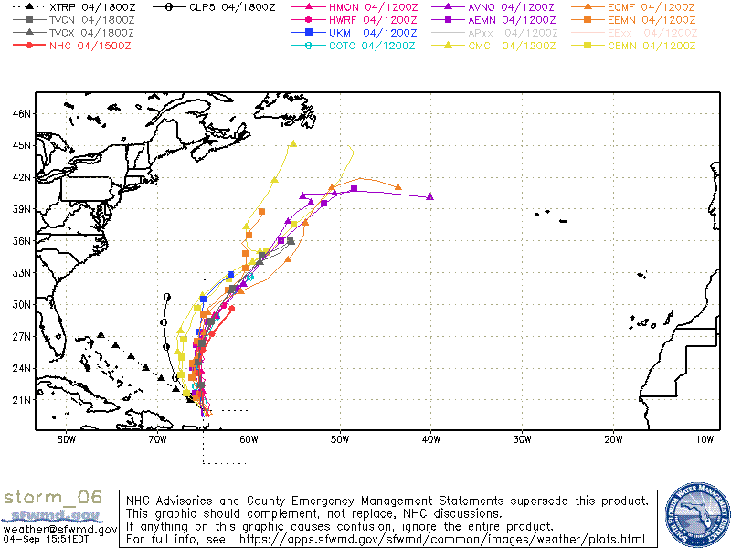
NWS National Hurricane Center Miami FL AL062022 500 AM AST Sat Sep 03 2022 Satellite imagery and radar data from Guadeloupe show that Earl remains a sheared tropical cyclone, with the low-level center located to the west of the main convective mass. Various satellite intensity estimates are in the 25-45 kt range and have changed little since the last advisory. Based on this, the initial intensity remains 35 kt. A NOAA Hurricane Hunter aircraft will investigate Earl starting near 1000 UTC. The initial motion is 285/11. The track guidance remains in good agreement that Earl should move west-northwestward and northwestward with a decrease in forward speed for the next couple of days as it is steered by the subtropical ridge. There is little change in this part of the forecast track from the previous advisory. After that time, a slower motion toward the north and eventually north-northeast is expected as a mid- to upper-level trough develops over the Atlantic to the west and north of Earl. The guidance envelope for the latter part of the forecast track has shifted eastward, and while the new forecast track is also nudged eastward it is west of the consensus models from 60-120 h. Earl is feeling the effects of moderate westerly shear, and current indications are this will continue for the next 48 h or so. Thus, the intensity forecast calls for modest strengthening during this time. The intensity forecast becomes more uncertain as Earl turns northward. While some shear is likely to continue, the dynamical models are in good agreement that the cyclone will strengthen, possibly due to a favorable interaction to the aforementioned upper-level trough. However, there is poor agreement between the models in the details of this interaction. Given that, the intensity forecast from 72-120 h will show a little more strengthening than the previous forecast. However, the forecast intensities are on the low side of the guidance envelope. Tropical-storm-force winds are forecast to remain on the northern and eastern side of the circulation, and as a result, are not expected to move across the northern Leeward Islands, the Virgin Islands, or Puerto Rico. However, any southward shift of Earl's center would increase the risk of tropical-storm-force winds in those areas. KEY MESSAGES: 1. Tropical Storm Earl is forecast to pass near or just to the north of the northern Leeward Islands, the Virgin Islands, and Puerto Rico over the weekend. Gusty winds, especially in squalls, area possible on those islands over the next day or two. 2. Heavy rainfall from Earl is expected to lead to limited flash, urban, and small stream flooding impacts over the Leeward Islands, U.S. and British Virgin Islands, and Puerto Rico this weekend. Rapid rises on rivers are possible in Puerto Rico. FORECAST POSITIONS AND MAX WINDS INIT 03/0900Z 18.7N 61.4W 35 KT 40 MPH 12H 03/1800Z 19.2N 62.8W 35 KT 40 MPH 24H 04/0600Z 19.9N 64.5W 40 KT 45 MPH 36H 04/1800Z 20.6N 65.6W 40 KT 45 MPH 48H 05/0600Z 21.2N 66.4W 40 KT 45 MPH 60H 05/1800Z 21.8N 67.0W 45 KT 50 MPH 72H 06/0600Z 22.6N 67.2W 45 KT 50 MPH 96H 07/0600Z 24.0N 67.0W 50 KT 60 MPH 120H 08/0600Z 25.5N 65.5W 55 KT 65 MPH |
|
|
|
|
|
09/03/2022 10:33 AM
|
|
|
1. Tropical Storm Earl is forecast to pass near or just to the
north of the northern Leeward Islands, the Virgin Islands, and Puerto Rico over the weekend. Gusty winds, especially in squalls, area possible on those islands over the next day or two. I believe that puts the swell in our window. Earl has a nice ring to it too. "Did you score some of the Earl swell?" ------------------------- I was right. |
|
|
|
|
|
09/03/2022 01:54 PM
|
|
|
Earl gonna unfurl and hurl us some pearls.
------------------------- Heavy is sign of reliability |
|
|
|
|
|
09/03/2022 03:17 PM
|
|
|
Tropical Storm Earl Discussion Number 4 NWS National Hurricane Center Miami FL AL062022 500 PM AST Sat Sep 03 2022 Earl has strengthened this afternoon. Satellite data indicate the previously exposed low-level center of the cyclone has been drawn underneath an area of deep convection, with cloud top temperatures colder than -70C. An Air Force Hurricane Hunter aircraft that recently investigated the storm reported max flight-level (925 mb) winds of 56 kt. This would support surface winds between 40 and 45 kt using a standard reduction factor. Based on these data, the cyclone's improved satellite structure, and falling surface pressures throughout the day, the initial intensity of Earl is raised to 45 kt for this advisory. The cyclone has strengthened some today despite facing moderate deep-layer southwesterly shear. The shear is forecast to persist or even increase during the next couple of days, so some fluctuation in intensity is possible if the deep convection gets stripped away and the center becomes exposed again. But, sea-surface temperatures greater than 29C should continue to support convective development, and the overall trend in the latest intensity guidance favors at least slow strengthening into early next week. Then, the models suggest that favorable interaction with an upper-level trough over the warm waters of the western Atlantic will promote additional strengthening, along with a broadening of the wind field. The latest NHC intensity forecast has been raised closer to the HCCA and IVCN consensus aids, and it now brings Earl up to hurricane strength at days 4-5. The initial motion of Earl is west-northwestward, or 290/9 kt. The general forecast track reasoning has not changed. Earl is expected to slow down as it moves west-northwestward to northwestward over the next couple of days. A weakness in the subtropical ridge should allow the cyclone to gradually turn northward early next week, then move northeastward as it becomes steered by a mid- to upper-level trough over the western Atlantic. The official NHC forecast track is very similar to the previous forecast and lies slightly to the left of the HCCA and TVCA aids. Tropical-storm-force winds are still forecast to remain on the northern and eastern side of the circulation, and are not expected to move across the northern Leeward Islands, the Virgin Islands, or Puerto Rico. However, gusty winds in squalls are possible at these locations through Sunday. KEY MESSAGES: 1. Heavy rainfall from Earl is expected to lead to limited flash, urban, and small stream flooding impacts over the Leeward Islands, U.S. and British Virgin Islands, and Puerto Rico this weekend. Rapid rises on rivers and mudslides in areas of steep terrain are possible in Puerto Rico. 2. Earl is forecast to pass to the north of the the Virgin Islands and Puerto Rico tonight and Sunday. Gusty winds, especially in squalls, area possible on those islands through Sunday. FORECAST POSITIONS AND MAX WINDS INIT 03/2100Z 19.3N 63.2W 45 KT 50 MPH 12H 04/0600Z 19.7N 64.3W 45 KT 50 MPH 24H 04/1800Z 20.5N 65.4W 50 KT 60 MPH 36H 05/0600Z 21.3N 66.0W 50 KT 60 MPH 48H 05/1800Z 22.2N 66.4W 55 KT 65 MPH 60H 06/0600Z 23.0N 66.6W 55 KT 65 MPH 72H 06/1800Z 24.1N 66.6W 60 KT 70 MPH 96H 07/1800Z 25.6N 65.6W 65 KT 75 MPH 120H 08/1800Z 27.7N 63.7W 75 KT 85 MPH |
|
|
|
|
|
09/03/2022 03:41 PM
|
|
|
TomPetty's middle name is makin waves!
|
|
|
|
|
|
09/03/2022 05:16 PM
|
|
|
Let's do dis!!!

------------------------- Time and tide wait for no one..... |
|
|
|
|
|
09/04/2022 10:38 AM
|
|
|
Maybe a little from Dannie tomorrow? On a holiday? Naaaa...
------------------------- add a signature since I'm here in profile anyway |
|
|
|
|
|
09/04/2022 10:42 AM
|
|
|
Oops, forgot, anti-jinx. Wink, turn around twice quick and spit. Whew.
------------------------- add a signature since I'm here in profile anyway |
|
|
|
|
|
09/04/2022 10:44 AM
|
|
|
only knew him as Tom
------------------------- Dora Hates You |
|
|
|
|
|
09/04/2022 01:53 PM
|
|
|
After 72 h, shear is expected to decrease, and
more robust intensification is possible thereafter, with the latest intensity forecast now making Earl a major hurricane by 120 h, in good agreement with the IVCN and HCCA consensus aids. |
|
|
|
|
|
09/04/2022 02:02 PM
|
|
------------------------- Dora Hates You |
|
|
|
|
|
09/04/2022 02:23 PM
|
|
|
Could be a "Major" by Friday !!
------------------------- Dora Hates You |
|
|
|
|
|
09/04/2022 02:38 PM
|
|
|
If we get a trickle of swell from this one we will be lucky.
|
|
|
|
|
|
09/04/2022 02:58 PM
|
|
|
And, , , , , the thing that just exited off the coast of Africa is forecast to do an Earl but, much further out in the Atlantic from us, , , , ,
Fish spinners. ------------------------- Dora Hates You |
|
|
|
|
|
09/04/2022 06:05 PM
|
|
|
Surfline is suggesting something for around Sept 13-14. Perhaps more interesting, Surf-Forecast.com is predicting 1000 kilojoules at some Brevard beaches southward for Mon. 12.
|
|
|
|
|
|
09/05/2022 05:01 AM
|
|
|
There's got to be at least a 3' swell before Sept 13th with 2 storms churning out there
Where are these waves going? Where are the generated waves breaking?
Hatteras? Bermuda?
|
|
|
|
|
|
09/05/2022 05:11 AM
|
|
|
Pretty morning. No good news.
------------------------- add a signature since I'm here in profile anyway |
|
|
|
|
|
09/05/2022 08:11 AM
|
|
|
If we get a trickle of swell from this one we will be lucky. Chest to head, with larger sets. Questionable form in Central Brevard. ------------------------- I was right. |
|
|
|
|
|
09/05/2022 08:21 AM
|
|

------------------------- Dora Hates You |
|
|
|
|
|
09/05/2022 08:32 AM
|
|
|
Cole - Report or Forecast? Your spot must be waaay better than mine?
------------------------- add a signature since I'm here in profile anyway |
|
|
|
|
FORUMS
:
Surfing
:
Tropical Storm Earl
|
Topic Tools |
FuseTalk Basic Edition - © 1999-2026 FuseTalk Inc. All rights reserved.