 |
2nd Light Forums |  |
|
Topic Title: Number Nine, , , ,Nine, , , Nine Topic Summary: Created On: 09/24/2024 03:48 AM |
Linear : Threading : Single : Branch |
 Topic Tools Topic Tools
|
|
|
|
|
Forceast to be "Major" when it hits the Big Bend.

------------------------- Dora Hates You |
|
|
|
|
|
|
|
|
Tropical Storm Helene Intermediate Advisory Number 5A
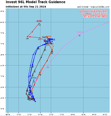
NWS National Hurricane Center Miami FL AL092024 200 PM EDT Tue Sep 24 2024 ...HELENE ORGANIZING OVER THE NORTHWESTERN CARIBBEAN SEA... ...HURRICANE AND STORM SURGE WATCHES REMAIN IN EFFECT FOR PORTIONS OF THE FLORIDA GULF COAST... SUMMARY OF 200 PM EDT...1800 UTC...INFORMATION ---------------------------------------------- LOCATION...19.4N 84.5W ABOUT 175 MI...280 KM ESE OF COZUMEL MEXICO ABOUT 175 MI...280 KM S OF THE WESTERN TIP OF CUBA MAXIMUM SUSTAINED WINDS...45 MPH...75 KM/H PRESENT MOVEMENT...WNW OR 295 DEGREES AT 12 MPH...19 KM/H MINIMUM CENTRAL PRESSURE...999 MB...29.50 INCHES DISCUSSION AND OUTLOOK ---------------------- At 200 PM EDT (1800 UTC), the center of Tropical Storm Helene was located near latitude 19.4 North, longitude 84.5 West. Helene has been wobbling a bit now that a well-defined has just recently formed, but the longer-term motion is toward the west-northwest near 12 mph (19 km/h). A turn toward the northwest is expected later today. A northward to north-northeastward motion at a faster forward speed is expected on Wednesday and Thursday. On the forecast track, the center of Helene will move across the far northwestern Caribbean Sea to near the northeastern coast of the Yucatan Peninsula of Mexico through tonight, and then move across the eastern Gulf of Mexico Wednesday and Thursday, potentially reaching the Gulf coast of Florida late Thursday. Maximum sustained winds are near 45 mph (75 km/h) with higher gusts. Strengthening is forecast, and Helene is expected to become a hurricane on Wednesday. Continued strengthening is anticipated after that time, and Helene could become a major hurricane on Thursday. Tropical-storm-force winds extend outward up to 140 miles (220 km) to the east of the center. Data from NOAA buoy 42056 indicate that the minimum central pressure is 999 mb (29.50 inches). FORECAST POSITIONS AND MAX WINDS INIT 24/1500Z 19.5N 84.3W 40 KT 45 MPH 12H 25/0000Z 20.3N 85.2W 50 KT 60 MPH 24H 25/1200Z 21.5N 86.3W 65 KT 75 MPH 36H 26/0000Z 23.2N 86.3W 80 KT 90 MPH 48H 26/1200Z 25.9N 85.4W 100 KT 115 MPH 60H 27/0000Z 29.7N 84.3W 100 KT 115 MPH 72H 27/1200Z 33.9N 83.9W 45 KT 50 MPH...INLAND 96H 28/1200Z 39.7N 86.8W 20 KT 25 MPH...POST-TROPICAL 120H 29/1200Z...DISSIPATED |
|
|
|
|
|
|
|
|
Tuesday evening "line" is directly over Tallahassee.
|
|
|
|
|
|
|
|
|
I hope they don't have Citizens...
------------------------- add a signature since I'm here in profile anyway |
|
|
|
|
|
|
|
|
Helene's explosive forecast one of the 'most aggressive' in hurricane history
Dinah Voyles Pulver, USA TODAY Tue, September 24, 2024 at 4:55 PM EDT· The forecast for Helene to transition from a potential tropical cyclone to a Category 3 hurricane appears to be the fastest progression ever predicted for a depression by the National Hurricane Center. "They had never forecast a major hurricane within 60 hours for a disturbance below tropical storm level," said Sam Lillo, a meteorologist and software engineer for DTN Weather, based on a computer analysis of the center's historical forecast data. "The entire forecast is also basically faster than has ever been seen for 36 hours and 48 hours from a tropical depression." ------------------------- Dora Hates You |
|
|
|
|
|
|
|
|
FORECAST POSITIONS AND MAX WINDS
INIT 25/0900Z 20.7N 86.2W 55 KT 65 MPH 12H 25/1800Z 21.9N 86.5W 70 KT 80 MPH 24H 26/0600Z 24.1N 86.2W 90 KT 105 MPH 36H 26/1800Z 27.4N 85.0W 105 KT 120 MPH 48H 27/0600Z 32.0N 84.2W 65 KT 75 MPH...INLAND 60H 27/1800Z 35.9N 85.4W 30 KT 35 MPH...POST-TROP/INLAND 72H 28/0600Z 37.0N 87.8W 20 KT 25 MPH...POST-TROP/INLAND 96H 29/0600Z 36.5N 88.0W 20 KT 25 MPH...POST-TROP/INLAND 120H 30/0600Z...DISSIPATED |
|
|
|
|
|
|
|
|
1000 AM CDT Wed Sep 25 2024
...HELENE BECOMES A HURRICANE... |
|
|
|
|
|
FORUMS
:
Surfing
:
Number Nine, , , ,Nine, , , Nine
|
 Topic Tools Topic Tools |
FuseTalk Basic Edition - © 1999-2026 FuseTalk Inc. All rights reserved.


