
 |
2nd Light Forums |
 |
 |  |


 |
- SurferMic | - 06/01/2020 07:29 AM |
|
- Plan B | - 06/01/2020 10:05 AM |
|
- Plan B | - 06/01/2020 12:03 PM |
|
- SurferMic | - 06/01/2020 02:43 PM |
|
- Cole | - 06/01/2020 05:36 PM |
|
- Central Floridave | - 06/01/2020 06:16 PM |
|
- Central Floridave | - 06/01/2020 06:18 PM |
|
- SurferMic | - 06/02/2020 05:47 AM |
|
- RocketSurf | - 06/03/2020 06:25 AM |
|
- SurferMic | - 06/03/2020 07:05 AM |
|
- Central Floridave | - 06/03/2020 05:38 AM |
|
- RocketSurf | - 06/03/2020 02:15 PM |
|
- johnnyboy | - 06/03/2020 02:29 PM |
|
- Plan B | - 06/03/2020 03:40 PM |
|
- SurferMic | - 06/03/2020 05:01 PM |
|
- Plan B | - 06/03/2020 05:38 PM |
|
- SurferMic | - 06/03/2020 06:17 PM |
|
- Cole | - 06/04/2020 05:56 AM |
|
- Plan B | - 06/04/2020 05:58 AM |
|
- Cole | - 06/04/2020 07:32 AM |
|
- Cole | - 06/04/2020 07:38 AM |
|
- larenyon | - 06/04/2020 07:59 AM |
|
- RiddleMe | - 06/04/2020 08:16 AM |
|
- weldertom2 | - 06/04/2020 06:57 AM |
|
- Plan B | - 06/04/2020 07:12 AM |
|
- johnnyboy | - 06/05/2020 10:39 AM |
|
- equipeola | - 06/05/2020 03:53 PM |
|
- cheaterfiveo | - 06/05/2020 05:03 PM |
|
- Cole | - 06/06/2020 03:47 AM |
|
- RocketSurf | - 06/06/2020 06:10 AM |
|
- Cole | - 06/06/2020 06:54 AM |
|
- sw | - 06/06/2020 12:18 PM |
|
- cheaterfiveo | - 06/06/2020 02:16 PM |
|
- Cole | - 06/06/2020 02:40 PM |
|
- surfmcc32 | - 06/06/2020 05:36 PM |
|
- Plan B | - 06/06/2020 07:46 PM |
|
- SunriseSurfer | - 06/07/2020 04:06 AM |
|
- RiddleMe | - 06/07/2020 05:00 AM |
|
- johnnyboy | - 06/06/2020 08:51 AM |
|
- weldertom2 | - 06/07/2020 06:17 AM |
|
- Cole | - 06/07/2020 06:49 AM |
|
- 910surfer | - 06/07/2020 07:39 AM |
|
- Cole | - 06/07/2020 07:42 AM |
|
- daner | - 06/07/2020 08:15 AM |
|
- Cole | - 06/07/2020 08:28 AM |
|
- johnnyboy | - 06/07/2020 11:05 AM |
|
- daner | - 06/07/2020 02:04 PM |
|
- harrietdubman | - 06/07/2020 03:54 PM |
|
- daner | - 06/07/2020 05:44 PM |
|
- Cole | - 06/08/2020 05:26 AM |
|
- SurferMic | - 06/08/2020 09:16 AM |
|
- StirfryMcflurry | - 06/08/2020 10:22 AM |
|
- SurferMic | - 06/08/2020 10:48 AM |
|
- harrietdubman | - 06/08/2020 11:36 AM |
 Topic Tools Topic Tools
|

 06/01/2020 07:29 AM 06/01/2020 07:29 AM


|
|
|
.
Edited: 06/04/2020 at 11:04 AM by SurferMic |
|
|
|
|
|
06/01/2020 10:05 AM
|
|
|
I dont think the direction will bode very well..... unless it blows up fast in the BOC, but even then.... swell may get beaten by the Missippi delta... but what do I know
Edited: 06/01/2020 at 10:18 AM by Plan B |
|
|
|
|
|
06/01/2020 12:03 PM
|
|
|
well.... GFS is pretty bullish (as usual) and has a much favorable fetch direction. EURO (who often does better with tropical systems) has it further west with not ideal direction (and not as strong).... we 'll see
|
|
|
|
|
|
06/01/2020 02:43 PM
|
|
|
.
Edited: 06/03/2020 at 06:33 PM by SurferMic |
|
|
|
|
|
06/01/2020 05:36 PM
|
|
|
That Beach Street is pretty damn fun.
But then again, so is chunky chop and there is no driving involved. ------------------------- I was right. |
|
|
|
|
|
06/01/2020 06:16 PM
|
|
|
Tropical Depression Three Discussion Number 1
NWS National Hurricane Center Miami FL AL032020 400 PM CDT Mon Jun 01 2020 Recent satellite data and surface observations from Mexico show that the circulation associated with the area of disturbed weather over the Yucatan peninsula has become better defined during the past several hours, and that the center has moved over the eastern portion of the Bay of Campeche. Although the deep convection has waned somewhat, there is evidence of banding in both visible satellite imagery and recent radar data from Sabancuy, Mexico. Based on these data, advisories are being issued on a tropical depression. The initial intensity is set at 25 kt, which is in agreement with earlier ASCAT data. The depression will be moving over the warm waters over the Bay of Campeche and upper-level winds are forecast to be generally conducive for strengthening during the next couple of days. The NHC forecast is in line with much of the intensity guidance and calls for the system to become a tropical storm in 12 to 24 hours, with some additional strengthening predicted through 48 hours while the system remains over the southern Bay of Campeche. After that time, the system's intensity will depend on how much it interacts with land. Although the latest runs of the GFS and ECMWF models take the cyclone inland over southern Mexico, the NHC forecast keeps it just offshore and shows the cyclone maintaining tropical storm strength. Later in the period, the guidance suggests that the system could strengthen over the south-central Gulf of Mexico, but the latter portion of the intensity forecast is of low confidence. The depression is moving west-northwestward or 290/6 kt. The system has been moving cyclonically around a larger gyre over Central America during the past couple of days, and while it remains embedded within the gyre it is forecast to turn west-southwestward, and then southward at a slower forward speed over the next couple of days. On this track, the cyclone is expected to move near the southern Bay of Campeche coast during the next day or two, and confidence it that portion of the track forecast is high. After that time, two distinct scenarios emerges. The first is that the cyclone continues moving southward and weakens or dissipates over the rugged terrain over southern Mexico. The latest runs of the ECMWF and GFS favor that scenario. In this scenario, both models show a new system developing near the south-central Gulf of Mexico from another vorticity center that rotates around the larger gyre. The second scenario, favored by the UKMET and some EC ensemble members, is for the depression to eject north-northeast moving into the central Gulf of Mexico by day 5. The NHC forecast favors the latter, but it is certainly possible that this tropical cyclone will move inland and dissipates and a new cyclone formation occurs later this week. The latter portion of both the track and intensity forecast are of quite low confidence. Key Messages: 1. The depression is expected to bring heavy rainfall to portions of southern Mexico, Guatemala, Honduras and El Salvador, which could cause life-threatening flash flooding and mudslides. Refer to products from your local weather office for more information. 2. Tropical storm conditions are expected along the coast of Mexico where a tropical storm warning is in effect. 3. The system is forecast to begin moving northward across the Gulf of Mexico later this week. However, it is too soon to specify the location and timing of any potential impacts along the U.S. Gulf Coast. Interests in these areas should monitor the progress of this system through the week and ensure they have their hurricane plan in place as we begin the season. FORECAST POSITIONS AND MAX WINDS INIT 01/2100Z 19.6N 91.2W 25 KT 30 MPH 12H 02/0600Z 19.8N 92.3W 30 KT 35 MPH 24H 02/1800Z 19.5N 92.8W 35 KT 40 MPH 36H 03/0600Z 19.2N 93.0W 40 KT 45 MPH 48H 03/1800Z 18.8N 93.2W 45 KT 50 MPH 60H 04/0600Z 18.8N 93.2W 45 KT 50 MPH 72H 04/1800Z 18.8N 93.2W 45 KT 50 MPH 96H 05/1800Z 19.0N 92.8W 45 KT 50 MPH 120H 06/1800Z 23.0N 91.0W 50 KT 60 MPH |
|
|
|
|
|
06/01/2020 06:18 PM
|
|

|
|
|
|
|
|
06/02/2020 05:47 AM
|
|
|
.
Edited: 06/03/2020 at 06:32 PM by SurferMic |
|
|
|
|
|
06/03/2020 06:25 AM
|
|
|
Edited: 06/04/2020 at 07:22 AM by RocketSurf |
|
|
|
|
|
06/03/2020 07:05 AM
|
|
|
.
Edited: 06/03/2020 at 06:32 PM by SurferMic |
|
|
|
|
|
06/03/2020 05:38 AM
|
|
|
Tropical Storm Cristobal Discussion Number 7
NWS National Hurricane Center Miami FL AL032020 400 AM CDT Wed Jun 03 2020 Cristobal has continued to get better organized this morning with the development of a small CDO feature over the low-level center, with cloud tops of -82C to -86C developing very near the center. Radar data from Sabancuy, Mexico, also has shown an improvement in the central convective features, along with an increase in convective banding on the west side of the circulation, which previously had been devoid of any significant convection. Reports from nearby Mexican observations indicate that winds of 47-48 kt exist west of the center, which supports an intensity of 50 kt. The same observations support a minimum pressure of 994 mb. The aforementioned surface observation data and radar imagery indicate that Cristobal is now moving southeastward or 140/03 kt. There could be some erratic motion this morning due to land interaction with the inner-core wind field, but the general motion should remain southeastward toward the coast of Mexico. By this afternoon, a turn toward the east is expected, driving the cyclone inland over southeastern Mexico where it could meander for the next day or two. By 48 hours, the global and regional models are in good agreement on the development of a long fetch of southerly flow on the east side of Cristobal between the cyclone's center and a ridge over the Bahamas and Hispaniola, which will act to lift the tropical storm slowly northward toward the south-central Gulf of Mexico. By 72 hours and beyond, mid-latitude ridging amplifies over the southeastern U.S. and the Bahamas, which will increase the southerly steering flow, causing Cristobal to accelerate northward on day 4 over the central Gulf, followed by a turn toward the north-northwest on day 5 near the south-central U.S. Gulf coast. The models are in very good agreement on this overall developing scenario, with only timing differences on when and how fast the cyclone will lift out away from Mexico. The new NHC track forecast is similar to the previous advisory track, and closely follows a blend of the consensus models TVCN and NOAA-HCCA. Some additional slight strengthening remains possible this morning before Cristobal moves inland over southeastern Mexico. Weakening is likely this afternoon and tonight while the circulation after landfall. The intensity forecast leans heavily on just how far inland Cristobal moves. For now, the cyclone is expected to remain relatively close to the warm Gulf waters, which should temper the rate of weakening typically experienced by inland tropical cyclones. But if Cristobal moves as far inland as Guatemala like the ECMWF and GFS models are forecasting, the cyclone would be considerably weaker and the wind field more expansive on days 3-5. The official intensity forecast is basically the same as the previous advisory, and closely follows the intensity consensus models IVCN and HCCA. Key Messages: 1. Damaging and deadly flooding has already occurred in portions of Mexico and Central America. Cristobal is expected to produce additional extreme rainfall amounts through the end of the week. The heaviest additional rainfall is expected over far southern Mexico and portions of the Yucatan Peninsula, while also extending along the Pacific coast from Chiapas to Guatemala and El Salvador. This rainfall could cause widespread life-threatening flash floods and mudslides. 2. Tropical storm conditions will continue along the coast of Mexico where a tropical storm warning is in effect. 3. Cristobal is forecast to begin moving northward across the Gulf of Mexico on Friday, and there is a risk of storm surge, rainfall, and wind impacts this weekend along portions of the U.S. Gulf Coast from Texas to the Florida Panhandle. While it is too soon to determine the exact location, timing, and magnitude of these impacts, interests in these areas should monitor the progress of Cristobal and ensure they have their hurricane plan in place. FORECAST POSITIONS AND MAX WINDS INIT 03/0900Z 18.9N 92.0W 50 KT 60 MPH 12H 03/1800Z 18.5N 91.8W 45 KT 50 MPH...INLAND 24H 04/0600Z 18.3N 91.5W 35 KT 40 MPH...INLAND 36H 04/1800Z 18.5N 91.1W 30 KT 35 MPH...INLAND 48H 05/0600Z 19.3N 91.0W 30 KT 35 MPH...OVER WATER 60H 05/1800Z 20.5N 90.9W 35 KT 40 MPH 72H 06/0600Z 22.2N 90.9W 40 KT 45 MPH 96H 07/0600Z 26.3N 90.5W 50 KT 60 MPH 120H 08/0600Z 29.8N 91.6W 55 KT 65 MPH...INLAND |
|
|
|
|
|
06/03/2020 02:15 PM
|
|
|
.
Edited: 06/04/2020 at 07:23 AM by RocketSurf |
|
|
|
|
|
06/03/2020 02:29 PM
|
|
|
I was looking at clearwater's forecast for Sunday. 9' at 11 seconds with 30mph wind side shore. What will that translate to?
------------------------- "One of the reasons why propaganda tries to get you to hate government is because it's the one existing institution in which people can participate to some extent and constrain tyrannical unaccountable power." Noam Chomsky. |
|
|
|
|
|
06/03/2020 03:40 PM
|
|
|
Current forecast = no go for Plan B
|
|
|
|
|
|
06/03/2020 05:01 PM
|
|
|
.
Edited: 06/03/2020 at 06:32 PM by SurferMic |
|
|
|
|
|
06/03/2020 05:38 PM
|
|
|
|
|
|
|
|
|
06/03/2020 06:17 PM
|
|
|
. Radio Silence..
Edited: 06/03/2020 at 06:32 PM by SurferMic |
|
|
|
|
|
06/04/2020 05:56 AM
|
|
|
This crap weather over Florida should be turning into another low any day now.
Well...a tropical low, obviously it's already some kind of low considering the rain. ------------------------- I was right. Edited: 06/04/2020 at 05:57 AM by Cole |
|
|
|
|
|
06/04/2020 05:58 AM
|
|
|
|
|
|
|
|
|
06/04/2020 07:32 AM
|
|
|
. Radio Silence.. Tracks slows..... Silence commences.... hmmm..... There are no secrets anymore. Zoo lineups in three, two, one.. ------------------------- I was right. |
|
|
|
|
|
06/04/2020 07:38 AM
|
|
|
http://www.spadre.com/
SUPs, logs and some guy on a hydrofoil just came zooming into the picture. lol ------------------------- I was right. |
|
|
|
|
|
06/04/2020 07:59 AM
|
|
|
There is a guy on the far outside on a foil sup. Nightmare. lol
|
|
|
|
|
|
06/04/2020 08:16 AM
|
|
|
There is a guy on the far outside on a foil sup. Nightmare. lol preach it brother |
|
|
|
|
|
06/04/2020 06:57 AM
|
|
|
Small and clean in South Padre Island this morning. Great forecast......... will be rocking late weekend in to next week.............legit
www.spadre.com |
|
|
|
|
|
06/04/2020 07:12 AM
|
|
|
Yep.... more direct fetch direction + better winds. Should be pumping!...... btw. just clicked that link, and immediately saw a guy go fully vertical twice, then finish with a 360 to end the wave.... DONT MESS WITH TEXAS! LOL.
|
|
|
|
|
|
06/05/2020 10:39 AM
|
|
|
This is the equivalent of the old surf shop report being busy the whole day there's waves.
------------------------- "One of the reasons why propaganda tries to get you to hate government is because it's the one existing institution in which people can participate to some extent and constrain tyrannical unaccountable power." Noam Chomsky. |
|
|
|
|
|
06/05/2020 03:53 PM
|
|
|
yikes! circ du soleil (sp)
------------------------- ola ~ |
|
|
|
|
|
06/05/2020 05:03 PM
|
|
|
south padre produces especially when the gulf is full of an storm heading north
|
|
|
|
|
|
06/06/2020 03:47 AM
|
|
|
This is the equivalent of the old surf shop report being busy the whole day there's waves. If you called Quiet Flight in the mid to late 80's, you probably got your surf report from me. ------------------------- I was right. |
|
|
|
|
|
06/06/2020 06:10 AM
|
|
|
2400
|
|
|
|
|
|
06/06/2020 06:54 AM
|
|
|
Swell headed to the Venice/Ana Maria area, but the storm is close enough to influence the wind, so the window might be short.
Padre looks smallish. ------------------------- I was right. Edited: 06/06/2020 at 06:58 AM by Cole |
|
|
|
|
|
06/06/2020 12:18 PM
|
|
|
2400 Haha, classic! 784 NA redial redial redial redial |
|
|
|
|
|
06/06/2020 02:16 PM
|
|
|
that was oceanside
|
|
|
|
|
|
06/06/2020 02:40 PM
|
|
|
South wind for the evening session. Not much swell, at least by our buoy measurements anyway.
http://www.ndbc.noaa.gov/stati...age.php?station=42098 Still kinda offshore winds in Venice. ------------------------- I was right. |
|
|
|
|
|
06/06/2020 05:36 PM
|
|
|
St Andrews looked good tonight, almost as crowded as I've ever seen it but hard to tell just saw Snapchat videos unfortunately sick with the flu. This place is kinda going off, some good breaks in that area but super sharky. http://www.aquaessence.com/index.cfm/m/54
|
|
|
|
|
|
06/06/2020 07:46 PM
|
|
|
|
|
|
|
|
|
06/07/2020 04:06 AM
|
|
|
More pics from Saturday of the west coast from Gulfster
A couple pics..... 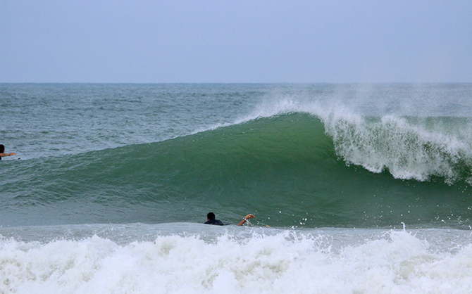
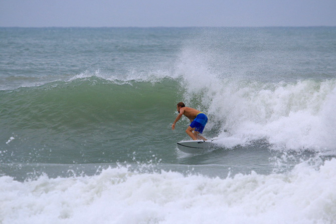
-------------------------  Puerto Rico 11 - 24 - 2013 Puerto Rico 11 - 24 - 2013
|
|
|
|
|
|
06/07/2020 05:00 AM
|
|
|
St Andrews looked good tonight, almost as crowded as I've ever seen it but hard to tell just saw Snapchat videos unfortunately sick with the flu. This place is kinda going off, some good breaks in that area but super sharky. http://www.aquaessence.com/index.cfm/m/54[/q You sure its the flu? Anyhow get better |
|
|
|
|
|
06/06/2020 08:51 AM
|
|
|
I'm bagging the trip. Three hours across the state in heavy thunderstorms to surf a heat high wave with a 20mph south wind on it is not enough for me. That's funny cole. Every surf shop did that. Mine was Island Water Sports. I remember my friend flying across my lawn to tell me the IWS surf report was off the hook. Literally. We all knew what that meant.
------------------------- "One of the reasons why propaganda tries to get you to hate government is because it's the one existing institution in which people can participate to some extent and constrain tyrannical unaccountable power." Noam Chomsky. |
|
|
|
|
|
06/07/2020 06:17 AM
|
|
|
South Padre going off this morning! Cam looks great - overhead and clean www.spadre.com
|
|
|
|
|
|
06/07/2020 06:49 AM
|
|
|
Okay Texas people, turn back into the pocket and quit outrunning the damn waves! It's not a race.
------------------------- I was right. |
|
|
|
|
|
06/07/2020 07:39 AM
|
|
|
Surfed Captiva yesterday afternoon and it wasn't like the pics. We missed it by 4 hours. We first drove to Anna Marie and it was barely thigh high.
|
|
|
|
|
|
06/07/2020 07:42 AM
|
|
|
Surf pics are the best waves of the best sets and unlike the saying, don't always tell a thousand words.
------------------------- I was right. |
|
|
|
|
|
06/07/2020 08:15 AM
|
|
|
Overhead, clean with jetty block but disorganized and breaking fast is the report from my son in the PCB area. Locally I surfed some reasonable knee to thigh SE windswell this am. Floaty board stuff.
------------------------- Replace turf grass with native plants that don't need irrigation and synthetic fertilizers or chemicals that can go into our waterways and ocean |
|
|
|
|
|
06/07/2020 08:28 AM
|
|
|
Overhead, clean with jetty block but disorganized and breaking fast is the report from my son in the PCB area. Locally I surfed some reasonable knee to thigh SE windswell this am. Floaty board stuff. Yep, there is a little south wedge behind the house that I plan on hitting when the day looks a little more friendly. ------------------------- I was right. |
|
|
|
|
|
06/07/2020 11:05 AM
|
|
|
Looked terrible in Lido Beach, where I wanted to go. Glad I saved the gas. Part of me wishes I just went to try, but there will be other opportunities.
------------------------- "One of the reasons why propaganda tries to get you to hate government is because it's the one existing institution in which people can participate to some extent and constrain tyrannical unaccountable power." Noam Chomsky. |
|
|
|
|
|
06/07/2020 02:04 PM
|
|
|
Zach just called. They scored 8 to 10 clean looong lefts at a break , Stoked for him and his buddies.
Edited to protect break identity. Srry got caught up in stoke. ------------------------- Replace turf grass with native plants that don't need irrigation and synthetic fertilizers or chemicals that can go into our waterways and ocean Edited: 06/08/2020 at 11:03 AM by daner |
|
|
|
|
|
06/07/2020 03:54 PM
|
|
|
------------------------- sneedeker Edited: 06/07/2020 at 03:56 PM by harrietdubman |
|
|
|
|
|
06/07/2020 05:44 PM
|
|
|
------------------------- Replace turf grass with native plants that don't need irrigation and synthetic fertilizers or chemicals that can go into our waterways and ocean |
|
|
|
|
|
06/08/2020 05:26 AM
|
|
|
But most videos on u tube take you to a tidal bore in South America.
------------------------- I was right. |
|
|
|
|
|
06/08/2020 09:16 AM
|
|
|
Sorry for those who reached out to ride along...it was too close to call...Looked at the long Range forecast for East Coast of FL and it is horrible for all of June!!! So made last min decision to go (was not planning on)...Well worth the trip Head high+ somewhere between Naples and the AL state line. Winds had just enough East early in the AM to be real fun , then it went S but it stayed fun. It's June and if there is a Headhigh+ wave in the state of FL I will be on it...can't fly anywhere right now...Now the crowds...INSANE, that's why we need to remove this thread...even my goto unknown spot was packed, luckily the talent level is lower on that coast, so any good surfer can get their's. I just put the shortboards back up in the rafters...gonna be a while before I need them again...Good to get one more shortbaord session in now that summer is here
Edited: 06/08/2020 at 10:13 AM by SurferMic |
|
|
|
|
|
06/08/2020 10:22 AM
|
|
|
was it head high +?
|
|
|
|
|
|
06/08/2020 10:48 AM
|
|
|
no just joking it was knee to thigh...it's never worth the drive over
Edited: 06/09/2020 at 05:45 AM by SurferMic |
|
|
|
|
|
06/08/2020 11:36 AM
|
|
|
thiccy rollers comin in ^
------------------------- sneedeker |
|
|
|
|
FuseTalk Basic Edition - © 1999-2024 FuseTalk Inc. All rights reserved.