
 |
2nd Light Forums |
 |
 |  |


|
Topic Title: Storm about to throw huge Ground Swells into the Florida Coast! Topic Summary: Created On: 08/19/2017 03:13 PM |
Linear : Threading : Single : Branch |
|
 Topic Tools Topic Tools
|

 08/20/2017 03:59 PM 08/20/2017 03:59 PM


|
|
|
Sounds like Dabuh has joined 2ndlight! lol ..... bite your tongue with that kinda talk. 
------------------------- "Most people would die sooner than think; in fact, they do." - Bertrand Russell "Morality is doing what is right, regardless of what you are told. Religion is doing what you are told, regardless of what is right. If I do not answer you .... nothing personal, I just have you on ignore. |
|
|
|
|
|
08/20/2017 04:22 PM
|
|
|
quit posting the booeys!!! ------------------------- https://www.instagram.com/dj_kaye_/ |
|
|
|
|
|
08/20/2017 05:49 PM
|
|
------------------------- The Wavecaster |
|
|
|
|
|
08/20/2017 06:27 PM
|
|
|
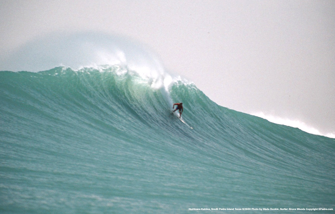
Damn, looks like Sunset Beach, HI
|
|
|
|
|
|
08/20/2017 07:34 PM
|
|
|
Hype is good
even if it is bad ------------------------- ... positioning and selection |
|
|
|
|
|
08/20/2017 08:06 PM
|
|
|
THE HYPE IS STRONG WITH THIS ONE ------------------------- Cameron Shearer |
|
|
|
|
|
08/21/2017 05:00 AM
|
|
|
|
|
|
|
|
|
08/21/2017 06:36 AM
|
|
|
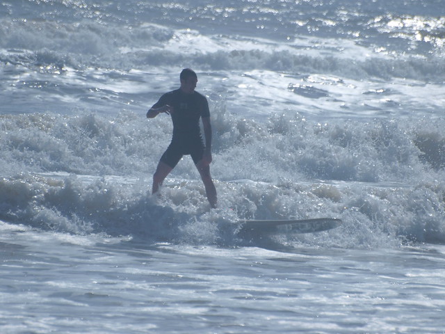
Must not have been that cold at Mavericks that day, no fullsuit...
Guess it's true what they say about Texas, I don't see no horns on that wave.... ------------------------- Brevard Surf Report |
|
|
|
|
|
08/21/2017 07:27 AM
|
|
|
|
|
|
08/21/2017 07:31 AM
|
|
|
What's on that bottom? Wicked rip at the bottom of the pic.
|
|
|
|
|
|
08/21/2017 08:19 AM
|
|
|
just looking around google maps on South Padre it seems like thats gotta be by that channel. probably gotta get super lucky to score any surf out there but seems like a cool area to explore lots of empty undeveloped beach |
|
|
|
|
|
08/21/2017 10:22 AM
|
|
|
That wave is on the northside of the north jetty, the rip is moving out along the jetty.
Inside the channel does break, super long left.

------------------------- The Wavecaster |
|
|
|
|
|
08/22/2017 12:56 AM
|
|
 SPI.. SPI..Tip quote: "That wave is on the northside of the north jetty, the rip is moving out along the jetty." Other than it's a Right, that wave and spot reminds me of surf'n big "Elbow". You know your surf'n, but it kinda feels weird to be do'in it 'here'-'there'. Kinda like have'n a dream and your surf'in a big ass peak at the corner of Hollywood and Vine or Haight and Ashbury, or during an Eclipse-
chingow- 3 in a row- I quit
------------------------- ola ~ |
|
|
|
|
|
08/22/2017 03:24 PM
|
|
|
3-5 foot today. Looks like he wasn't all wrong :Shaka: ------------------------- https://www.instagram.com/dj_kaye_/ |
|
|
|
|
|
08/22/2017 07:33 PM
|
|
|
6 feet in the "Texan Scale", , , , Yep Ain't no surf in Texas I surfed that swell that day . Water was 92 degrees waves were best I ever surfed all day long Friendliest crowds on the planet what stoke!!!! |
|
|
|
|
|
08/22/2017 09:55 PM
|
|
|
Guys sorry to see that the strom kinda fizzled out for you guys. Texas is gonna get obliterated with rain. P-Cola and Panama City might be a good wave. We'll have to see what happens. |
|
|
|
|
|
08/23/2017 03:08 PM
|
|
|
South Florida might get some homegrown NE swell next week. Winds look offshore too. |
|
|
|
|
|
08/24/2017 07:03 AM
|
|
|
I've seen that photo before, but I'm trippin everytime I seen it. "Sunset" was the first thing that came to mind too I caught some great surf in the panhandle from the that stom, but that waves like that in the Gulf is next level shit..... excuse me, let me dust off my 7-6... for TEXAS?!?!
I'm guessing that inside left is like the Pass in Panama City? |
|
|
|
|
|
08/24/2017 08:49 AM
|
|
|
Harvey predicted to go Cat two on latests:
Tropical Storm Harvey Discussion Number 16 NWS National Hurricane Center Miami FL AL092017 1000 AM CDT Thu Aug 24 2017 Data from an Air Force Hurricane Hunter aircraft indicate that Harvey is quickly strengthening, and the cyclone's structure has improved markedly with the plane reporting a closed 15-20 n mi wide eye. The flight-level and SFMR winds support an intensity of 55 kt, but one of the more notable measurements is the central pressure, which has fallen to 982 mb. With a pressure this low, it is likely that the winds will respond and increase further, and Harvey probably isn't too far from becoming a hurricane. With Harvey now strengthening at a faster rate than indicated in previous advisories, the intensity forecast has become quite concerning. Water vapor images indicate that the cyclone's outflow is expanding--indicative of low shear--and Harvey will be moving over a warm eddy of high oceanic heat content in the western Gulf of Mexico in about 24 hours. As a result of these conditions, several intensity models, including the ICON intensity consensus, are now explicit showing Harvey reaching major hurricane intensity. What's more astounding is that some of the SHIPS Rapid Intensification indices are incredibly high. As an example, the guidance is indicating a 70 percent chance of Harvey's winds increasing by 45 kt over the next 36 hours. Based on this guidance, the NHC official intensity forecast now calls for Harvey to reach major hurricane strength by 36 hours, before it reaches the middle Texas coast. Aircraft fixes indicate that Harvey has turned toward the north- northwest, and the initial motion estimate is 340/9 kt. A mid- level high centered near Florida and the eastern Gulf of Mexico should force Harvey toward the northwest later today, with that trajectory continuing for the next couple of days. By 48 hours, the cyclone appears to get sandwiched between the same mid-level high over the Gulf of Mexico and a larger high over the Intermountain West, which will cause Harvey to slow down considerably during its approach toward the Texas coast and then potentially stall just inland on days 3 through 5. Mainly based on an adjustment of the initial position, the NHC forecast track has been nudged northeastward on this cycle, but it still lies relatively close to the TVCN multi-model consensus and the HFIP Corrected Consensus Approach (HCCA). It is critical that users not focus on the exact forecast track of Harvey, since cycle-to-cycle adjustment are likely. All locations within the hurricane and storm surge warning areas should be preparing for the possibility of major hurricane-force winds and life-threatening storm surge. Key Messages: 1. Harvey has intensified quickly this morning, and is now forecast to be a major hurricane at landfall, bringing life-threatening storm surge, rainfall, and wind hazards to portions of the Texas coast. Preparations to protect life and property should be completed by tonight, as tropical-storm-force winds will first arrive in the hurricane and storm surge warning areas on Friday. 2. A Storm Surge Warning is in effect for much of the Texas coast. Life-threatening storm surge flooding could reach heights of 6 to 10 feet above ground level at the coast between the north entrance of the Padre Island National Seashore and Sargent. For a depiction of areas at risk, see the Storm Surge Watch/Warning Graphic at hurricanes.gov. 3. Life-threatening flooding is expected across much of the Texas coast from heavy rainfall of 12 to 20 inches, with isolated amounts as high as 30 inches, from Friday through early next week. Please refer to products from your local National Weather Service office and the NOAA Weather Prediction Center for more information on the flooding hazard. 4. The Potential Storm Surge Flooding Map is available on the NHC website. This product depicts a reasonable worst-case scenario - the amount of inundation that has a 10 percent chance of being exceeded at each individual location. This map best represents the flooding potential in those locations within the watch and warning areas. FORECAST POSITIONS AND MAX WINDS INIT 24/1500Z 24.0N 93.3W 55 KT 65 MPH 12H 25/0000Z 24.9N 94.2W 70 KT 80 MPH 24H 25/1200Z 26.0N 95.3W 90 KT 105 MPH 36H 26/0000Z 27.3N 96.3W 100 KT 115 MPH 48H 26/1200Z 28.3N 97.0W 95 KT 110 MPH...INLAND 72H 27/1200Z 29.0N 97.7W 40 KT 45 MPH...INLAND 96H 28/1200Z 28.5N 97.5W 35 KT 40 MPH...INLAND 120H 29/1200Z 28.5N 96.5W 30 KT 35 MPH...INLAND |
|
|
|
|
|
08/24/2017 09:00 AM
|
|
|
|
|
|
|
|
FORUMS
:
Surfing
:
Storm about to throw huge Ground Swells into the F...
|
Topic Tools |
FuseTalk Basic Edition - © 1999-2024 FuseTalk Inc. All rights reserved.